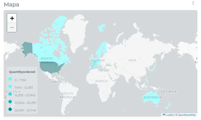

Upload a map
Edalitics allows the import of geojson files, with a linkage to different attributes of the data source, in order to generate layer maps linked to those attributes.
How to import a geojson file into the data model
Section titled “How to import a geojson file into the data model”To import a geojson file, follow the next steps:
- Go to the corresponding option of the management menu and select the data source to be changed:
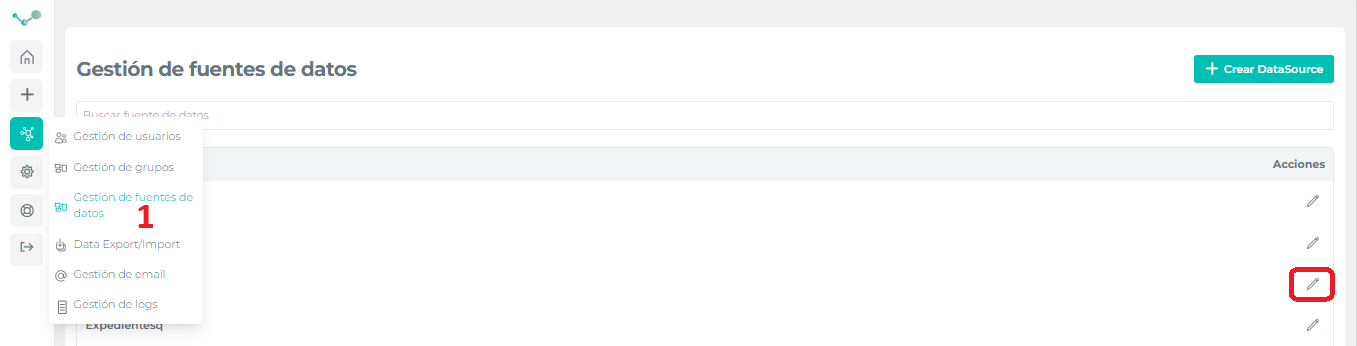
- Select the model and click on “Maps” in the extend the model menu:
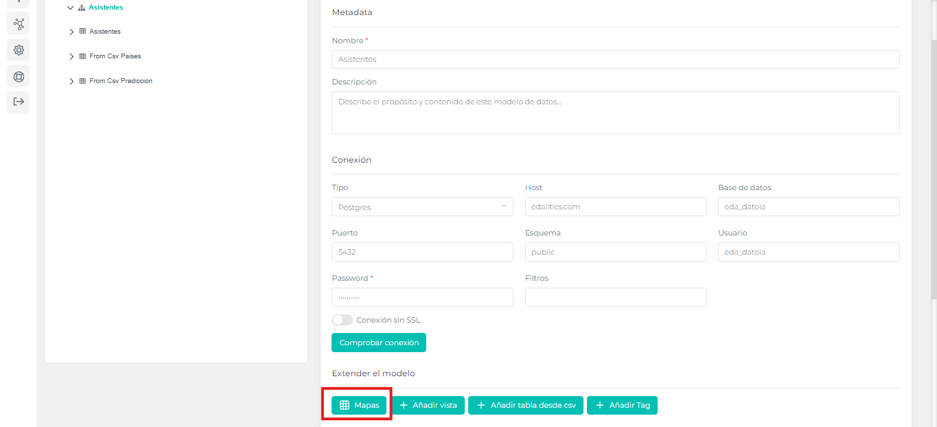
We will arrive at the following panel:
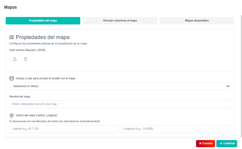
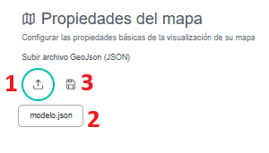
- Click on the icon (1), choose the geojson file. Once selected, it will appear in the field (2), finally click on the save icon (3):
How to link a map with an attribute
Section titled “How to link a map with an attribute”In order to create data in layered maps, it is necessary to link the geojson file we have just imported with an attribute of our data model.
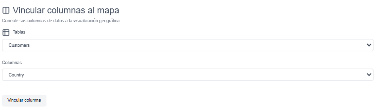
In this example we will look for the variable “name” of the geojson file and link it to the table “Clients”, column “Country”, which will contain the country names.
To link an attribute to the new imported map follow these steps:
- Select the field in the geojson file that will be used as the binding identifier with the table.

- Type coordinates of the map center (OPTIONAL).

- Choose the table and column that will be binding to the map.
Video tutorial
Section titled “Video tutorial”Enable map in the data model
Section titled “Enable map in the data model”With the map-attribute linkage completed, you can now display queries with the type “Layer map”.
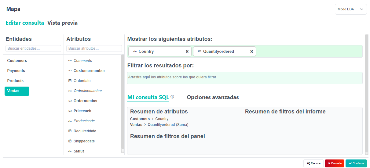
Create or modify a query of the current data model. Choose the attribute linked in the previous steps.
Go to preview and choose “Layer Map” as the query type. You can only choose it if you have chosen the linked attribute in the previous step.
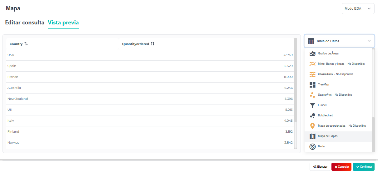
At the end of the process you should have a query similar to the following one: